
Reality Capture
& LiDAR.
Understand the building as it stands. Measured existing conditions for design, pricing, fabrication, and construction.
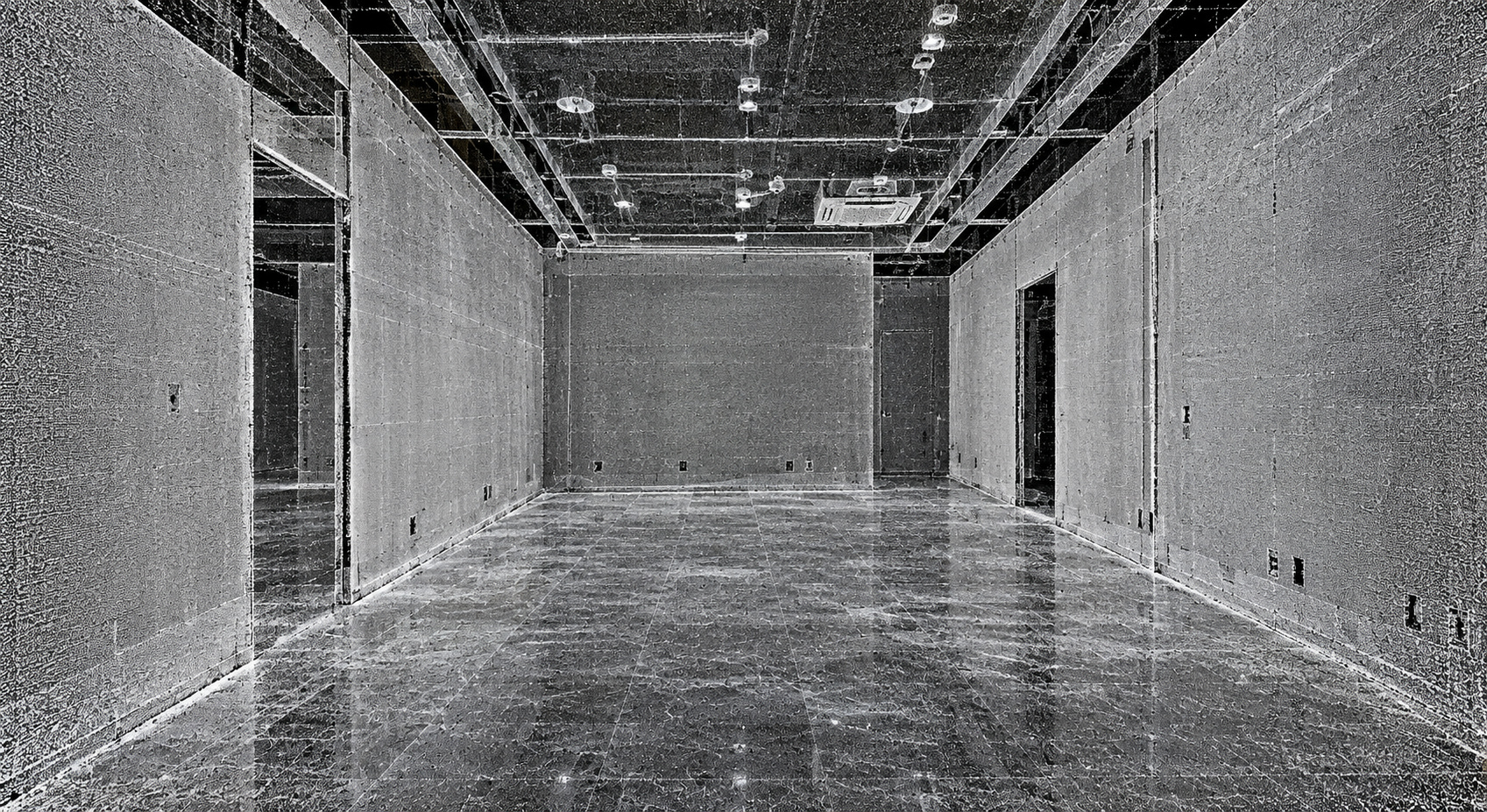
A measurable spatial record of the captured environment, available to revisit after the site visit.
Capture the Environment.
Not Only the Dimensions.
A measurement answers a specific question. Reality capture preserves the surrounding conditions, so the project team can investigate additional dimensions and relationships as the work develops.
DNA Group combines LiDAR and laser scanning with aerial capture, photography, site observations, and targeted field verification. The approach is selected around the building, access, required accuracy, intended use, and agreed deliverables.
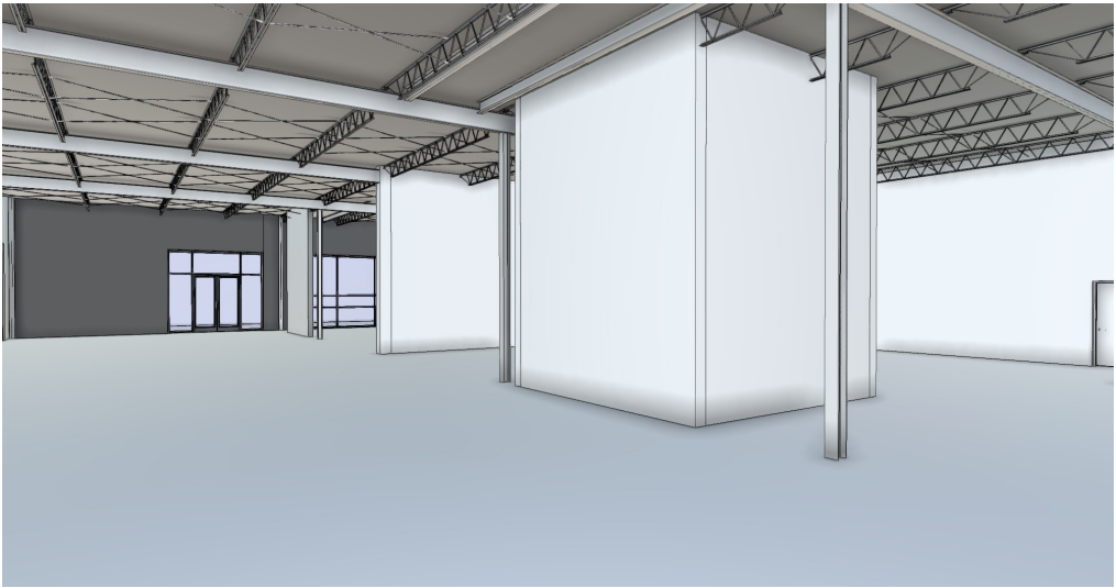
Captured information can be developed into point clouds, measured drawings, and existing-condition models, creating a shared starting point for owners, designers, consultants, contractors, and fabricators.
The Right Tool.
For the Right Condition.
Ground-based scanning, aerial capture, and site documentation each provide different information. We select the approach around the building and the decisions the record needs to support.
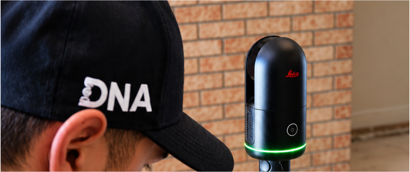
DNA Group on site.
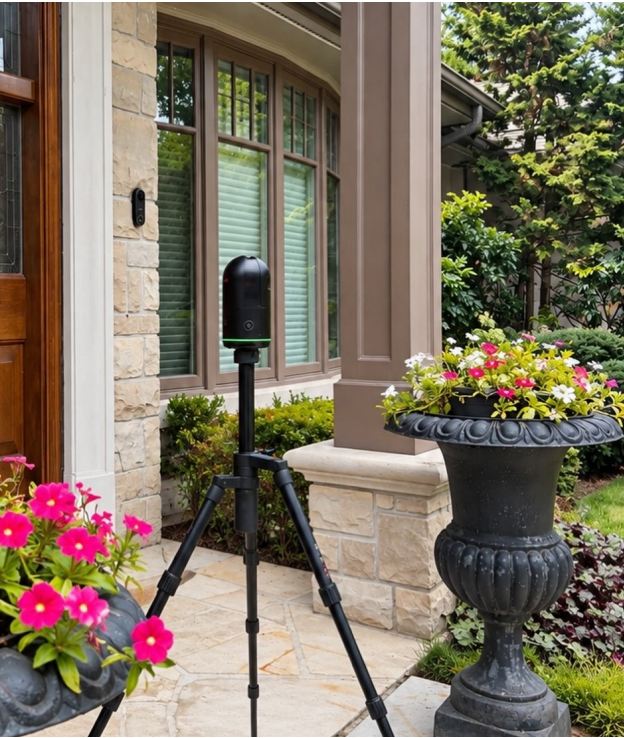
Ground-based laser scanning records visible building geometry, structure, openings, equipment, and exposed services.
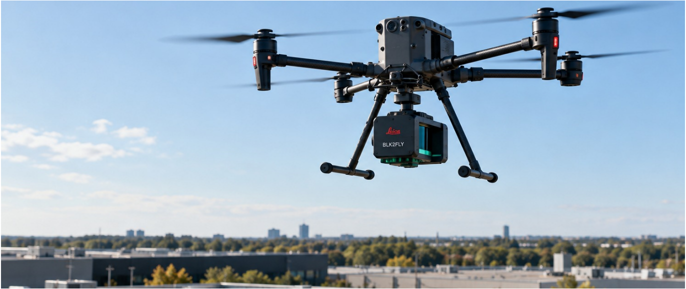
Aerial capture.
Document roofs, facades, rooftop equipment, and exterior conditions using the aerial workflow suited to the project.
A Better Starting Point.
Establish what is already there first, then carry that information through the stages that follow. One record supports design, pricing, fabrication, construction, and future use of the asset.
Capture
Record the building as it is.
LiDAR + laser scanning · Aerial · 360° · Photography · Field verification
Document
Turn captured data into usable drawings.
Point cloud · As-built plans · Elevations · Sections
Model
Rebuild the space digitally.
Existing-condition model · Scan-to-BIM
Coordinate
Test proposed work against reality.
BIM / VDC · Clash detection · Design coordination · Constructability
Plan
Price and plan from documented information.
Budget · Scope · Procurement · Schedule · Sequencing · Logistics
Build
Construct with coordinated information.
Construction management · General contracting · Installation coordination
Record
Keep the information working.
Updated as-builts · Digital building record · Maintenance · Renovations · Capital planning
↳ The record becomes the starting point for the next project.
One Capture.
A More Useful Starting Point.
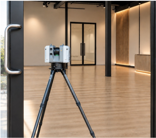
01 / Capture
Record accessible building conditions using the capture methods selected for the project.
02 / Register & Review
Organize scan data into a measurable point cloud and review coverage against the agreed scope.
03 / Document & Develop
Turn captured information into drawings or models suited to the decisions the team needs to make.
The Right Tool.
The Right Information.
Start with the decision the information needs to support, then define the capture method and deliverables.
01LiDAR & Ground-Based Laser Scanning
Record detailed geometry across visible walls, floors, ceilings, structure, openings, equipment, and exposed services. Registered scan data creates a spatial record that can be revisited for measurement and review.
02Aerial Capture & Exterior Documentation
Document roofs, facades, rooftop equipment, sites, and exterior conditions that are difficult to reach. Where the equipment and workflow support it, aerial data can also inform mapping and 3D documentation. Access, site conditions, and the intended use determine the scope.
03Photography, 360° & Field Verification
Supplement scanning with detailed photographs, 360-degree documentation, observations, and targeted measurements. Critical dimensions and conditions are verified separately where required.
04Measured As-Built Documentation
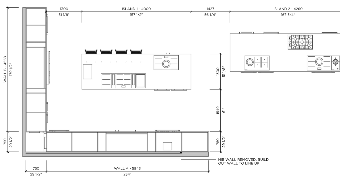
Develop existing-condition floor plans, dimensioned plans, reflected ceiling plans, elevations, sections, equipment layouts, and visible service locations from the captured information. Deliverables are scoped to the project.
05Point-Cloud Sections & Elevations
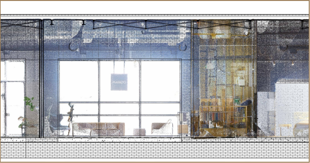
Review the captured building through section cuts and elevations to understand geometry, levels, structure, openings, and visible services. Section views can reveal relationships that selected measurements alone do not describe.
06Fabrication & Installation Surveys
Document the space surrounding proposed millwork, glazing, metalwork, signage, equipment, or architectural features. Review the geometry, interfaces, tolerances, and access the installation must work within.
07Scan-to-BIM Inputs
Provide captured information as a basis for existing-condition modelling and subsequent coordination. Detailed model development, multidisciplinary integration, and clash detection are covered by our BIM / VDC services.
08Digital Asset Records
Create an organized record that can support future renovations, tenant improvements, maintenance, and capital planning. Records should be updated at turnover and as the building changes.
Drawn from the Building.
Grounded in Existing Conditions.
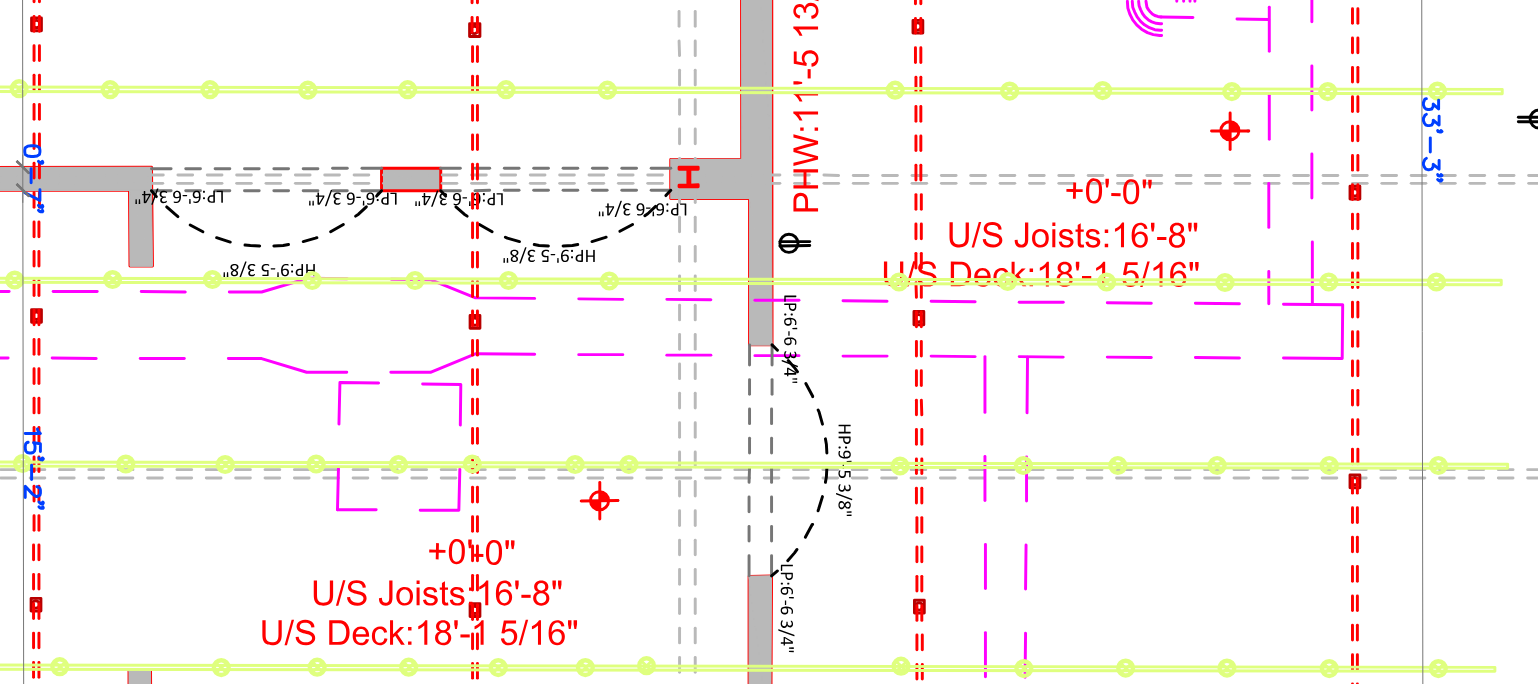
Captured geometry supports measured plans, elevations, and sections for interior and exterior work. Openings, ceiling levels, structure, equipment, and visible services can be documented within the agreed scope.
For fabrication, understanding what surrounds an opening or installation is as important as its width. The record helps teams review returns, adjacent surfaces, clearances, and irregular geometry.
Scanning records visible surfaces. Concealed conditions, hidden services, and critical dimensions require appropriate investigation or field verification.
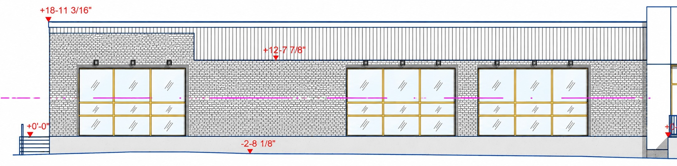
Information the Team
Can Work From.
A fit-out, a fabrication package, and an asset record need different outputs. Deliverables are agreed around intended use rather than a standard package.
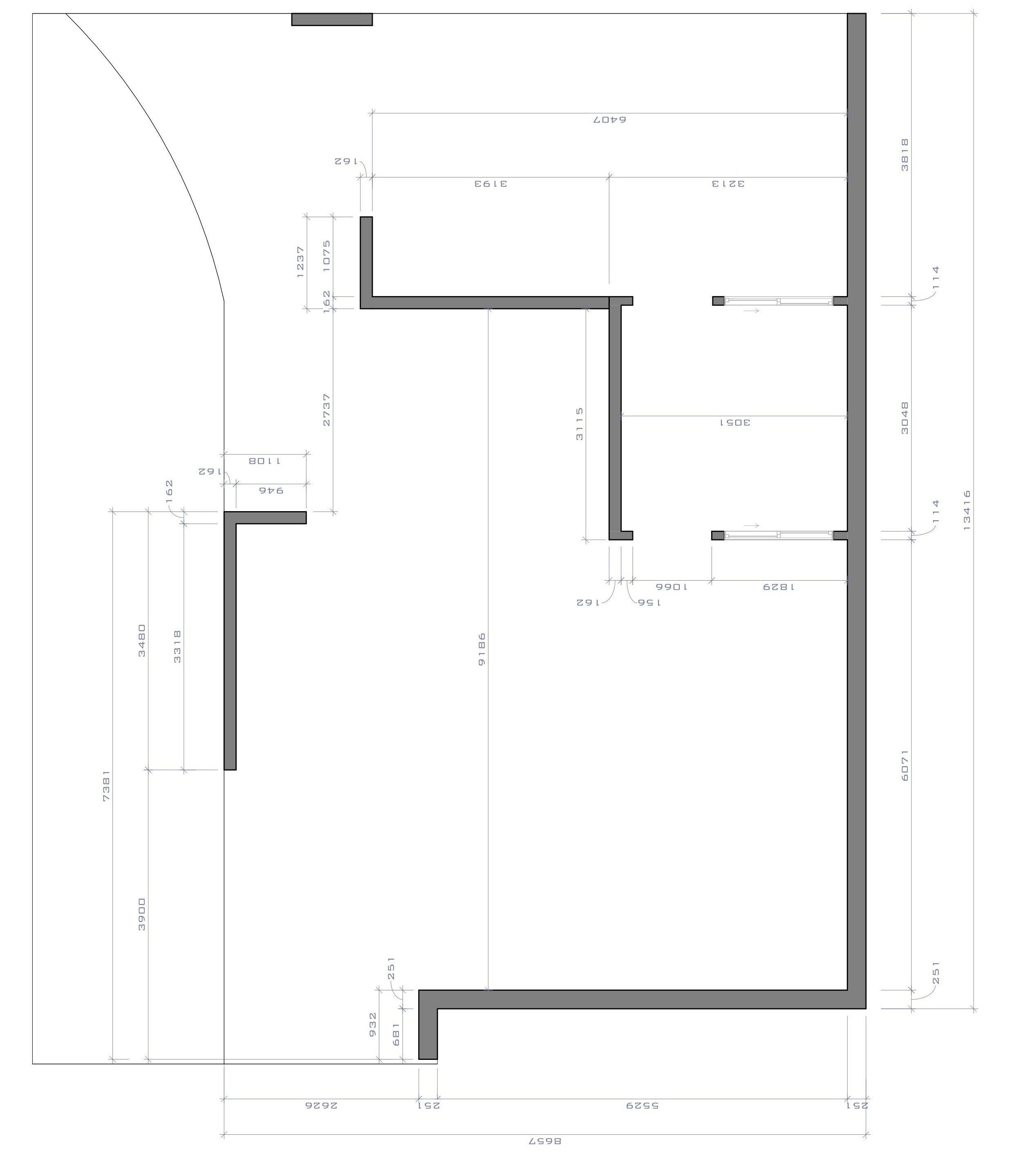
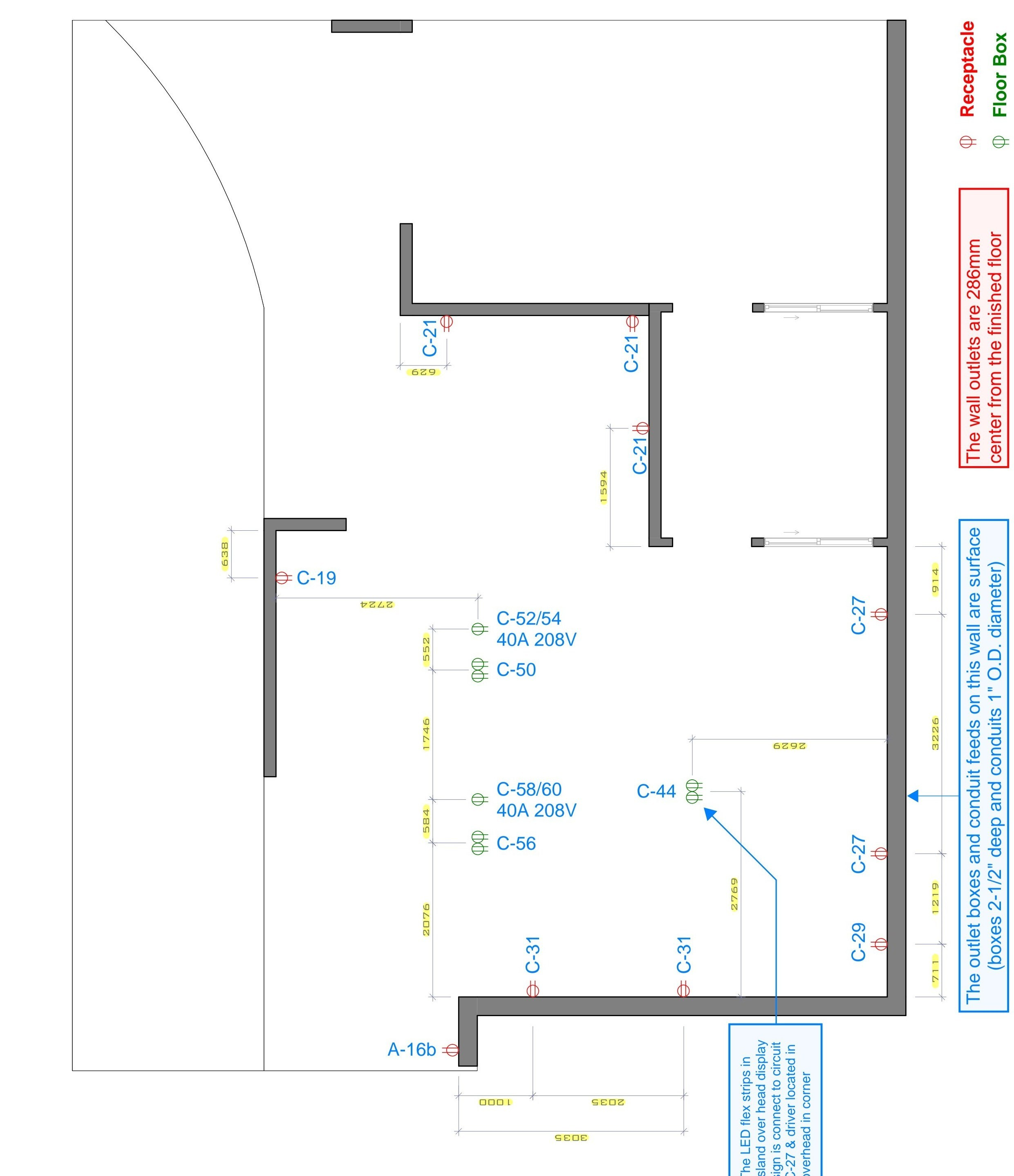
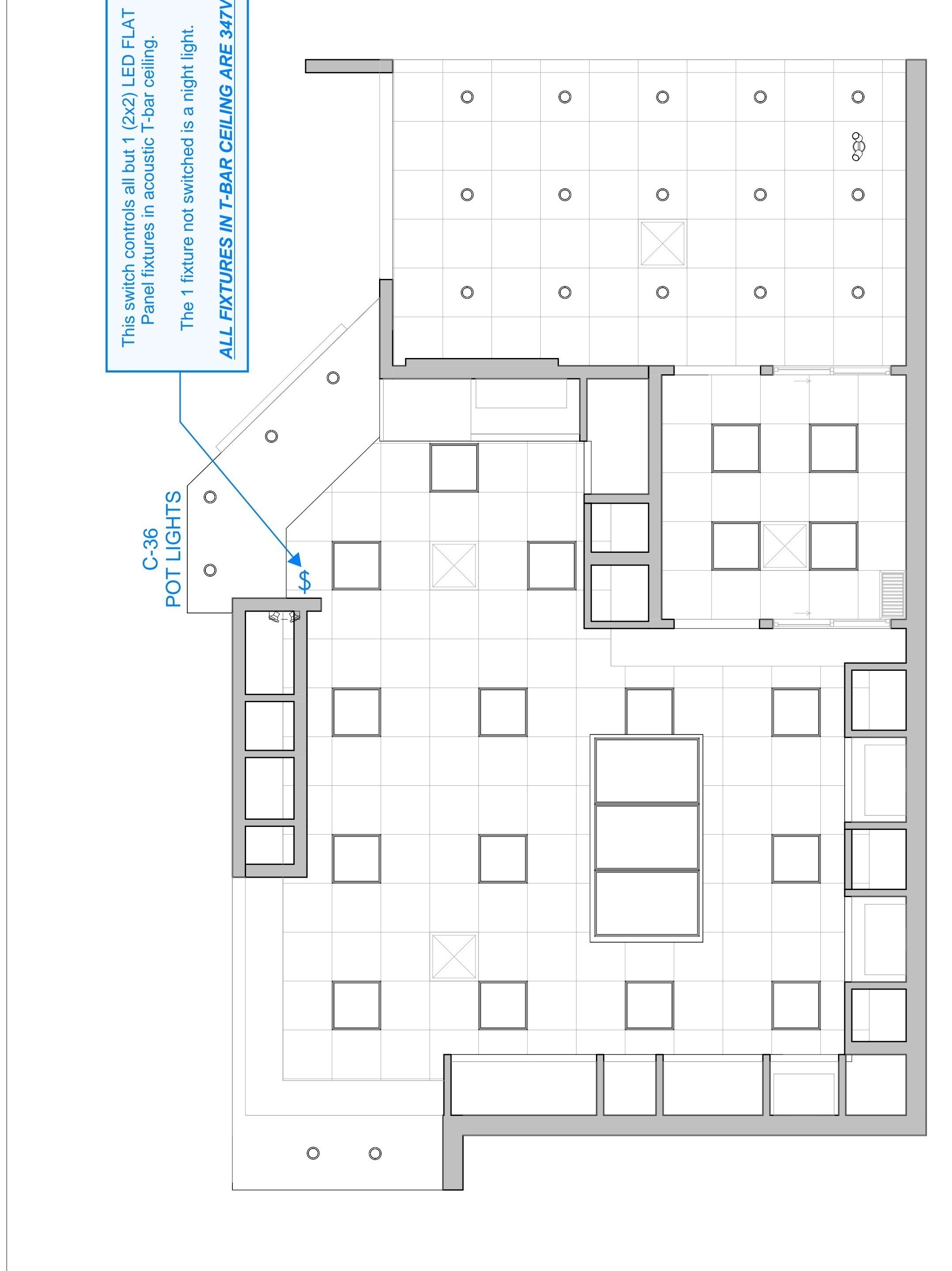
- Point-cloud data
- Plans, elevations & sections
- CAD files
- PDF drawing sets
- Existing-condition models
- Revit models, where scoped
See the Relationships.
Review the Levels.
Section cuts through the registered point cloud make relationships between storefronts, structure, ceilings, ductwork, and fit-out easier to inspect. Measured levels provide context for design and installation decisions.



Capture Once.
Create Value Many Times.
The objective is lasting information about the physical asset, extending beyond the immediate project.
A scan completed for one project can support operations, maintenance, leasing, tenant improvements, and capital planning, particularly when it is updated at turnover and as the building changes.
Project information becomes asset information.
The record can remain useful after construction, giving the next project team a more informed starting point.
Project information
- Acquisition
- Due diligence
- Feasibility
- Design
- Pre-construction
- Procurement
- Fabrication
- Construction
- Turnover
Asset information
- Operations
- Maintenance
- Leasing
- Tenant improvements
- Future renovations
- Capital planning
- Future consultant work
- Future construction
DIGITAL BUILDING RECORD — captured early · updated at turnover · updated as the building changes
Existing Buildings
Are Not Perfect Geometry.
A wall can measure correctly at one location and bow elsewhere. A floor can be level at one control point and vary across the installation. Corners, ceiling heights, columns, and services may differ from old drawings.
Reality capture provides a denser picture of the visible geometry, helping teams identify these conditions before they become installation problems.
Millwork in context.
Traditional approach: measure wall width, height, openings, and selected control dimensions.
Reality-capture approach: document the wall and surrounding floor, ceiling, openings, bulkheads, columns, visible services, and irregular geometry.
Result: shop drawings developed with a clearer understanding of the space the millwork occupies and the conditions it must meet.
Millwork installs into a building, not simply into a dimension.
Selected dimensions can miss the geometry between measurement points.
PARTICULARLY USEFUL FOR: built-in millwork, custom cabinetry, wall-to-wall installations, architectural metalwork, glazing, storefronts, feature walls, custom ceilings, architectural features, signage, cladding, and equipment installations.
When a dimensional issue is found changes the response.
During documentation
Review the captured condition.
During design
Adjust the drawing and coordinate the interface.
During fabrication
Review production changes and material implications.
During installation
Field modification, delay, remobilization, or remake may be needed.
Late discoveries can lead to repeat site visits, revised shop drawings, remanufacturing, waste, added labour, damage to finished work, and disruption to other trades. Better information can reduce avoidable problems; it does not remove every risk.
One Record.
Every Discipline.
Owners & asset managers
A documented building for leasing, tenant improvements, maintenance, renovations, and capital planning.
Developers
Better inputs for feasibility, scope, pricing, and decisions before major commitments.
Designers & engineers
Measured existing conditions for design, documentation, and coordination in context.
Fabricators & manufacturers
Clearer geometry, tolerances, interfaces, and access information before production and installation.
Contractors & construction managers
A shared record for estimating, trade scopes, sequencing, and earlier issue review.
Facility teams & occupiers
Usable references for service work, occupied-space projects, and future upgrades.
The record supports project decisions and future investigations; required specialist assessments and field verification remain part of the process.
A Clear Capture Workflow.
Define the purpose before the site visit, then carry the information into usable records and agreed deliverables.
- 01
Define
Confirm scope, intended use, access, required accuracy, and deliverables.
- 02
Capture
Record accessible conditions with the selected scanning and documentation methods.
- 03
Document
Register and review the information, then produce the agreed drawings or model inputs.
- 04
Apply
Deliver the record for design, pricing, fabrication, coordination, or asset use.
Capture. Document.
Coordinate. Build.
Connect the captured record with BIM / VDC for modelling and coordination, and Pre-Construction for scope, budget, procurement, and delivery planning.
Understand What's There.
Plan What Comes Next.
Tell us about the building, the areas to be documented, access conditions, and how you intend to use the information. We will help define the capture approach and deliverables.